Mavourn.
Bolnhurst.
Location
Grid Reference TL071575
Latitude 52.206176° Longitude -0.4330621°
The The Historic Environment Record for Bedfordshire says:-
Summary
The site consists of the remains of a medieval moated enclosure, fishponds, occupation and cultivation earthworks. The moat has an outer ditch on the west side and external banks to the east. The outer edge of the moat measures 95m by 80m, including a partially waterfilled ditch 9m wide. The post medieval farmhouse and associated buildings can be seen in the interior of the enclosure, and to the east of the house a series of low earthworks indicates the position of part of the earlier medieval house. North of the moat are the remains of a number of fishponds connected by a series of supply and outflow channels. Also to the north are the earthworks of a deserted medieval settlement, consisting of a series of building platforms, garden plots, ditches and a hollow-way leading towards the moat. Between the fishponds and the moat are two square enclosures, possibly horticultural. The site is referred to as "Maverns" or "Mavyon" in sixteenth century documentary sources. It was owned by Canons Ashby Priory from at least the 13th century until the 1540s. Occupation on the site may date back as far as the 8th century, as a decorated gilt bronze disc of that date was found at the farm in 1962. Mavourn was amalgamated with the neighbouring manor of Glintells or Glintills, and Lintells appears as a field name on the 1847 Tithe map, presumabaly derived from Glintells.
Aerial
2D LIDAR
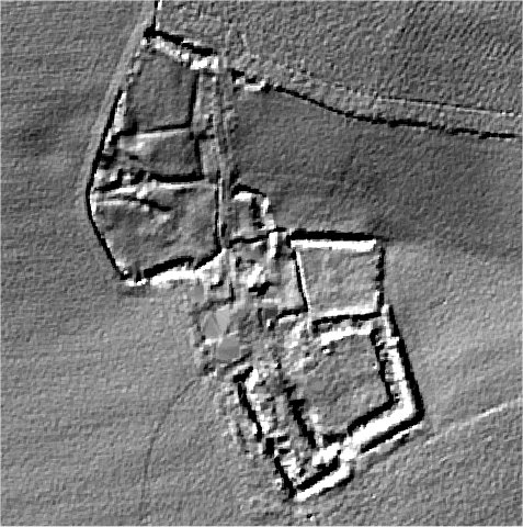
3D LIDAR interactive
3d_rotation Left mouse button to rotate.
swap_horiz Right mouse button to pan.
swap_vert Centre scroll wheel to zoom.