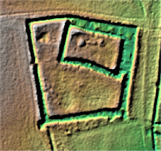
The Camp.
Bushmead.

Location

Grid Reference TL117603

Latitude 52.229828 Longitude -0.3648492

The The Historic Environment Record for Bedfordshire says:-

Summary

The site lies 160m north of the Eaton Socon to Bushmead road, on the south side of the valley of the Duloe Brook. It includes a large medieval moated enclosure containing a smaller moated island, and a series of leats leading to the south which formerly regulated the supply of water to a pair of contemporary fishponds.

Full description at the Historic Environment Record.

Aerial

2D LIDAR

LIDAR

3D LIDAR interactive

3d_rotation Left mouse button to rotate.
swap_horiz Right mouse button to pan.
swap_vert Centre scroll wheel to zoom.

Click to open interactive 3D Lidar in separate window