Park Farm.
Eaton Bray.
Location
Grid Reference SP959209
Latitude 51.879295° Longitude -0.6067887°
The The Historic Environment Record for Bedfordshire says:-
Summary
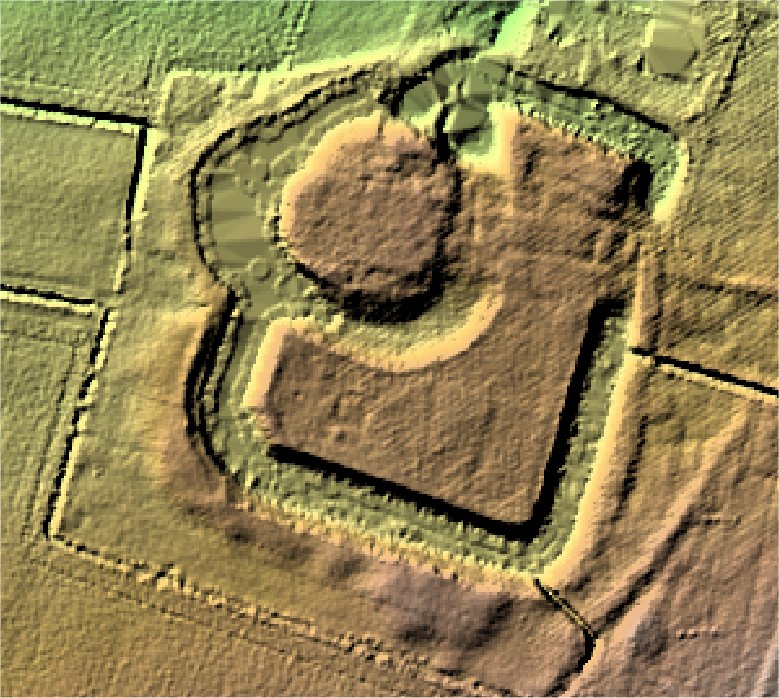
A moated site on level ground some 800m west of Eaton Bray, comprising a large rectangular moated enclosure which contained a smaller circular moated island in which a fortified manor house once stood. The moats are located in the north eastern part of the former deer park (HER13970) and also associated are 2 fishponds which lie in the E and NW (HER10652) corners of the park. All are elements of a Scheduled Monument (1011713) protected in 6 separate areas. Constructed by William de Cantilowe in the early 13th century, the site is frequently referred to as a "castle" but was more likely a fortified manor of some prominence in the landscape. An Inquisition Post Mortem at the death of George, William's successor, in 1274 provides an inventory of the structures located on the islands, within the moats, which at the time were strengthened by walls and entered by two drawbridges. The inner island contained an elaborate hall and a granary. The outer ward supported numerous outbuildings including stables for 60 horses. This document also mentions a "new chapel", which may represent the final fulifilment of a grant by Merton Priory in 1211. The manor was rebuilt by the Bray family during the reign of Henry VIII, and the earlier hall on the inner island was replaced by a building of three ranges. By 1675, when the owner, Sir John Huxley, died, the manor was empty and in a considerable state of disrepair. Huxley's son undertook to repair the damage, and a document of 1692 refers to a manor, now known as Eaton Park House, surroundeed by barns , stables and other outbuildings including a "stone dovehouse" and a malthouse. The manor is depicted within the moat on Jeffery's Map of Bedfordshire in 1765, although it was finally demolished in 1794. By 1849 the site had been cleared of all standing remains and is recorded on the Tithe Map of that date as an area of pasture, termed "Park Gardens".
Aerial
2D LIDAR
3D LIDAR interactive
3d_rotation Left mouse button to rotate.
swap_horiz Right mouse button to pan.
swap_vert Centre scroll wheel to zoom.