The Camp.
Higham Gobion.
Location
Grid Reference TL104329
Latitude 51.9840337° Longitude -0.3934495°
The The Historic Environment Record for Bedfordshire says:-
Summary
An earthwork comprising a central mound and a roughly triangular outer bank, with a group of fishponds outside the south east corner. The site is a Scheduled Ancient Monument and has been scheduled as a motte and bailey castle, but the site has also been interpreted as a fishery, possibly manorial. The outer bank does not appear defensive, and the area inside seems to be designed to be flooded. The mound, although it resembles a motte, was possibly intended as a nesting island.
Aerial
2D LIDAR
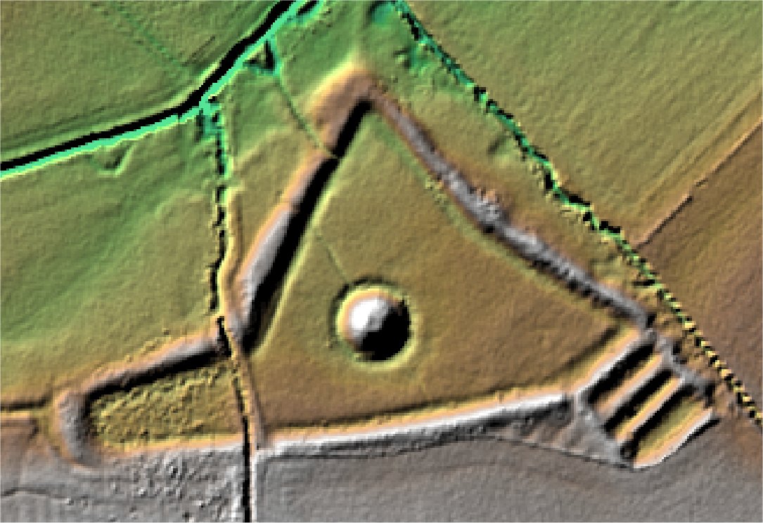
3D LIDAR interactive
3d_rotation Left mouse button to rotate.
swap_horiz Right mouse button to pan.
swap_vert Centre scroll wheel to zoom.