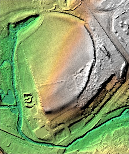
Wallud's Bank.
Leagrave.

Location

Grid Reference TL061246

Latitude 52.910307° Longitude -0.4580947°

The The Historic Environment Record for Bedfordshire says:-

Summary

D-shaped earthwork enclosure, probably an Iron Age enclosed settlement overlying earlier late Neolithic and early Bronze Age settlement activity.

Full description at the Historic Environment Record.

Aerial

2D LIDAR

LIDAR

3D LIDAR interactive

3d_rotation Left mouse button to rotate.
swap_horiz Right mouse button to pan.
swap_vert Centre scroll wheel to zoom.

Click to open interactive 3D Lidar in separate window