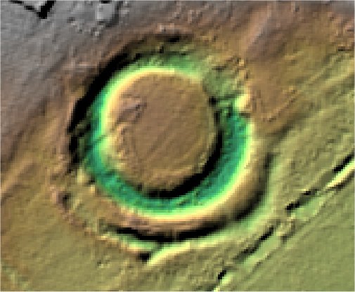
The Manor.
Westoning.

Location

Grid Reference TL041585

Latitude 51.215614° Longitude -0.4773112°

The The Historic Environment Record for Bedfordshire says:-

Summary

Circular medieval moated site, with associated rectangular enclosures. Maps of 1842 show entrances to the north and west sides of the moat. The moat has been dated to the late 13th/early 14th century when the manor of Westoning was owned by William Inge, Chief Justice to Edward II. The site is a Scheduled Monument.

Full description at the Historic Environment Record.

Aerial

2D LIDAR

LIDAR

3D LIDAR interactive

3d_rotation Left mouse button to rotate.
swap_horiz Right mouse button to pan.
swap_vert Centre scroll wheel to zoom.

Click to open interactive 3D Lidar in separate window