The Castle.
Bletsoe.
Location
Grid Reference TL024584
Latitude 52.214548° Longitude -0.5019788°
The The Historic Environment Record for Bedfordshire says:-
Summary
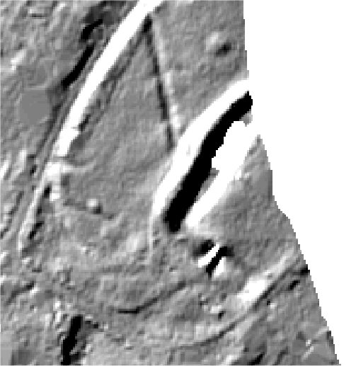
Bletsoe Castle is a medieval moated manor house with associated 16th-17th century garden enclosure and landscape earthworks. The moated area is almost square in plan, surrounded by a ditch measuring up to 25m wide by 3.5m deep with an outer bank 2m high and 5m wide. The western arm of the moat has been partly filled in and landscaped into modern gardens but is still 2m deep and 10-15m wide; there is no outer bank on this side. The southern corner of the moat lies beneath a group of farm buildings which includes a 17th-18th century barn (Grade II listed). The interior of the moated area measures at least 70m across and is the site of Bletsoe Castle, an Elizabethan manor house (Grade II*, HER 231). Crossing the moat in front of the house is a Grade II listed, 16th century stone bridge; the line of the track leading to the bridge is visible as an earthwork in the field to the south west. To the south east of the moat, and beyond the farm buildings, is a square enclosure earthwork thought to be the site of a formal garden datinig from the late 16th or early 17th century. It measures 80m wide and is bounded on three sides by a double bank either side of a single ditch. The inner bank is steep, up to 2m high and topped by a hedge; the outer bank is less substantial and the ditch is 8m wide and less than 0.5m deep. Around the castle and garden are the remains of medieval field system earthworks, enclosed by a boundary bank. Close to the north eastern boundary is a pond, fed by a leat diverted from the nearby stream.
Aerial
2D LIDAR (Partial coverage)