Church Panel
Shillington
Location
Grid Reference TL118350
Latitude 52.002345° Longitude -0.3721672°
The The Historic Environment Record for Bedfordshire says:-
Summary
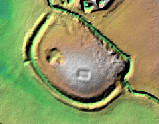
Earthworks of a D-shaped moated enclosure approximately 160m by 120m, situated on the south western end of a low promontory. The southern and western arms of the moat follow natural contours so that the interior of the enclosure is 0.5m higher than the ground outside. The north eastern arm runs straight across the promontory; here the ditch is deeper, carrying a diverted stream, and there are no banks. The eastern half of the island is artificially raised by about 2m and on top of this plateau is a rectangular building platform, approximately 12m by 15m. A 2m deep pit on the lower western half of the island is an old quarry. An infilled ditch, about 10m wide, runs adjacent to the western arm of the moat on a north to south alignment; this was a drain, but also served to strengthen the moat. Originally interpreted as a Danish earthwork but almost certainly a later, medieval, moated site. The site is a Scheduled Monument.
Aerial
2D LIDAR
 ------------------------ -->
3D LIDAR interactive
3d_rotation Left mouse button to rotate.
swap_horiz Right mouse button to pan.
swap_vert Centre scroll wheel to zoom.