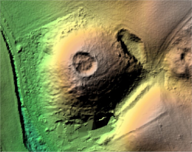
Seymour's Clump.
Steppingley.

Location

Grid Reference TL000350

Latitude 52.004964° Longitude -0.5432464°

The The Historic Environment Record for Bedfordshire says:-

Summary

A circular hollow with a low earthwork bank around its perimeter sited on top of a small west-facing greensand spur north of Warren Farm. Possibly created as an observation point westwards but could alternatively be associated with a medieval rabbit warren.

Full description at the Historic Environment Record.

Aerial

2D LIDAR

LIDAR

3D LIDAR interactive

3d_rotation Left mouse button to rotate.
swap_horiz Right mouse button to pan.
swap_vert Centre scroll wheel to zoom.

Click to open interactive 3D Lidar in separate window