Biggin Wood.
Tempsford.
Location
Grid Reference TL181527
Latitude 52.160699° Longitude -0.2748483°
The The Historic Environment Record for Bedfordshire says:-
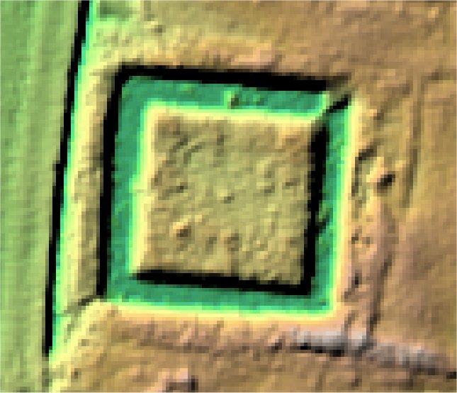
The site comprises the well-defined remains of a medieval moated enclosure and the levelled remains of an outer enclosure. The moated enclosure is square in form measuring approx 67m across inclusive of the 8m wide surrounding moat. The partially water-filled ditches form a complete circuit apart from a recently infilled section at the north east corner. There is no visible evidence for the original entrance causeway known to have been on the western side. The interior of the moated island is flat. The moated enclosure is contained within a larger rectangular enclosure, the boundary ditch of which has been levelled, although its below ground remains survive. The site is believed to be the location of the manor of Biggin or Everton Biggin.
Aerial
2D LIDAR
3D LIDAR interactive
3d_rotation Left mouse button to rotate.
swap_horiz Right mouse button to pan.
swap_vert Centre scroll wheel to zoom.