The Green
And the old Bedford to Luton road
Long before the A507 east-west bypass was built in 1975 and before the dual carriageways were built to the north and south in 1938, the A6 used to run through the area known as the The Green at the west end of the village.
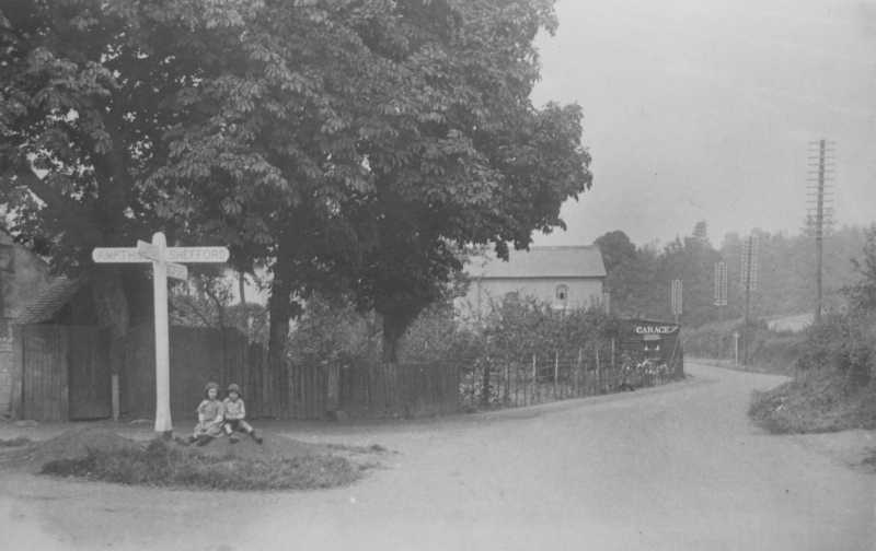 The old crossroads looking north up the A6 towards Bedford, Diggins' Garage and the Wesleyan Chapel.
The A6 road from Bedford came down the hill past the Wesleyan Methodist Chapel and Diggins' Garage to a junction.
The road from Ampthill and Maulden joined it from the west.
It then turned left past the Flying Horse and continued along the south side of The Green past the lockup and pound towards the old bridge.
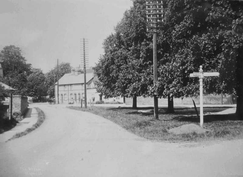 The Green looking west towards the A6 from the bridge. The lockup is to the left.
It then went over the old bridge and south past the Primitive Methodist Chapel to join the current A6 road at the point where there is now a filling station.
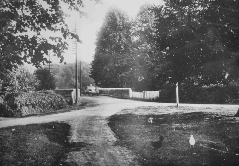 Old Bridge looking south from The Green
The Flying Horse
The Flying Horse public house was a popular inn in the old coaching-days for travellers from London to the north and would have been a staging post where the horses were changed.
Later there was a bus garage in the yard where the buses were stored overnight.
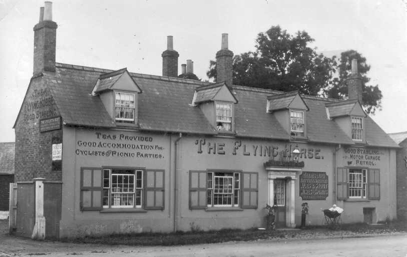 Flying Horse. Note the child in a pram left outside!
On the wall it advertises:-
Teas provided.
Good accommodation for cyclists & picnic parties.
Good stabling
Motor garage
Petrol.
This shows the transition from horse-drawn to motorised transport.
The Green
There are four large trees on the Green; three are European Limes and one is a Small-leaved Lime. The photos, taken in the 1900s, show that they were a good size then so they must be well over 100 years old.
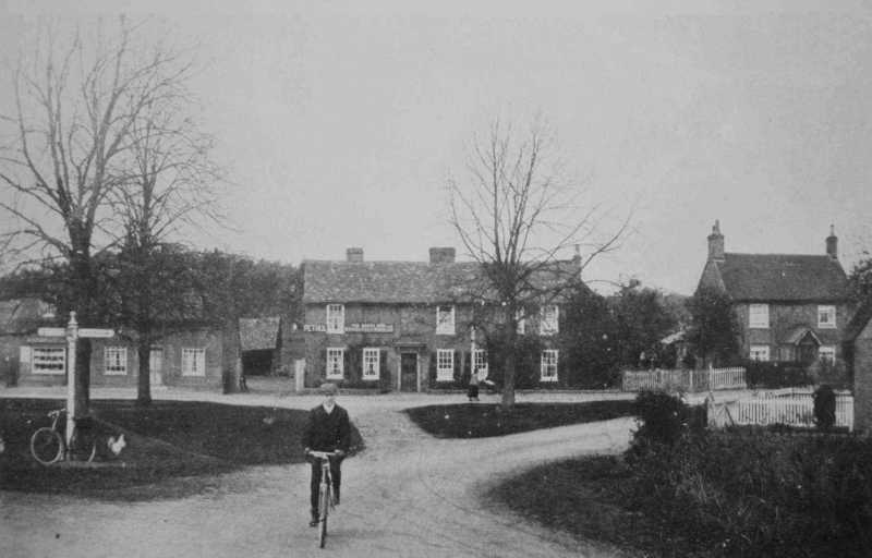 The Green looking north towards the Green Man
The two triangles of grass are registered as a village green under the Commons Registration Act 1965.
This area is very small for a village green so it probably came about more as a traffic junction than a traditional common.
The Old Bridge
The Old Bridge, which has been demolished and replaced with a modern one, had been the main river crossing since at least the 18th century.
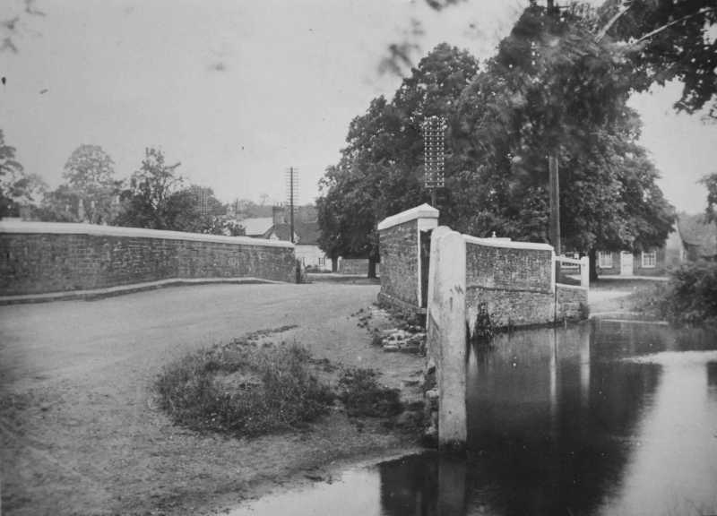 Looking north across the Old Bridge to the lime trees on The Green
To the east side of the bridge was a ford where animals could be watered or containers filled.
New route
There was a wall to the west of The Flying Horse which had to be demolished to make way for the new road south.
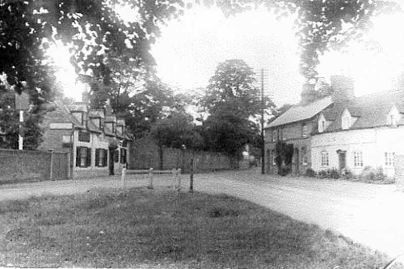 The Green looking west past the Flying Horse to the wall that was demolished
Behind the wall was Maulden Cottage, the home of the two spinster daughters of Captain Moore, a JP who had the lockup built in 1851.
 The breached wall looking south where the new road is being constructed
The photo shows the new road junction with signs to Silsoe and Luton.
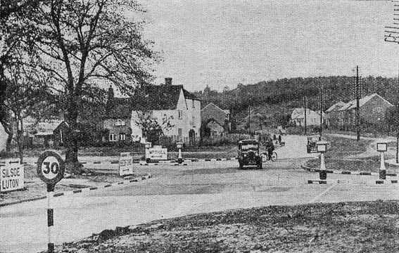 The new junction (with new signs)
Map comparisons
The first comparison is betweem a map showing the original route of the A6 road (through The Green and over the Old Bridge), and a map showing the new route to the west of The Flying Horse Inn.
The second comparison shows the "new" bypass severing the Old Silsoe Road.
Drag the blue circles to compare maps.
